Saturday, November 14, 2015

Ghosts Of The Cowboys: Vermilion Cliffs, Arizona Strip

Highway 89A on the Arizona Strip.

Early November, and back to the Arizona Strip. That lonely, austere, beautiful high desert land between Grand Canyon and the Utah state line.


Welcome to the Vermilion Cliffs National Monument.
The Marble Platform, the flat shelf above the Marble Canyon portion of the Grand Canyon of the Colorado River. Sagebrush and saltbush and bare soil in between. Soil and stones and bedrock. 


The Vermilion Cliffs and approaching early winter storm.

And lots of blue sky, normally. But not today. Winter was approaching, and I wanted to be there.

I might be that rare person that, when the weather forecast indicates a snow storm coming into an area, I head for it instead of away. Well, at least in late fall I do. I love the changing of the seasons. And not being sweaty just by sitting outside doing nothing at the time, relaxing. And not having to clean the bug guts off the windshield yet again that day.

Simple things.

The clouds were very low, enveloping the Kaibab Plateau just to the west. Snowing up there. But not down here on the Platform. Not yet. If the weather forecaster man in Flagstaff was right, it would be snowing right about this elevation -- 5,000 feet -- before the day was done. So I was hopeful.


Vermilion Cliffs cowboy cabin ruin.
From Highway 89A I drove onto a sandy BLM (Bureau of Land Management) road that headed straight north toward the Cliffs. It was a spot I'd visited before, and it had an historic red rock cowboy cabin ruin.


Cowboy cabin light and shadows. The roof is gone, but not the rafters.
I walked out back of the cabin to take in more of the scenery, of the brilliant light. The corrals are still there. It was clear that this had been no quick, thrown-together deal. A lot of work had gone into it. A cement truck had been driven back here, for the poured concrete foundation of the cabin, and the cement watering or feeding troughs out back, I don't know which.


Corrals and winter storm light, Vermilion Cliffs.
Stock pens and approaching storm clouds, Vermilion Cliffs.
Cowboy cabin ruin and Vermilion Cliffs.
Approaching winter storm, Vermilion Cliffs, Arizona Strip.
Corral, Cliffs, and storm clouds.


Storm clouds, red sand, and sagebrush.
I imagined living there. I'm no cowboy. Just a naturalist, a lover of nature, the land. But just like back then, you have to have a livable income. Otherwise you will have to leave, and your house will start aging back into the landscape.

Photo location: Marble Platform and Vermilion Cliffs National Monument, Coconino County, Arizona.

© Copyright 2015 Stephen J. Krieg

Thursday, November 12, 2015

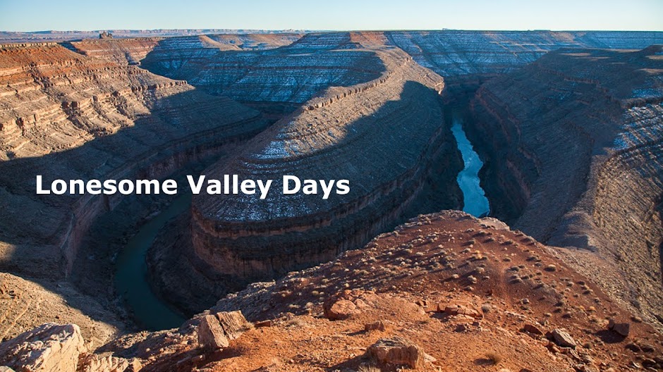
Lonesomest Award: Utah Highway 72

Fishlake National Forest, from Highway 72

Autumn is the greatest season of all. That's a given. Unless you love summer or spring more. In that case I can't help you.

Because nothing can touch autumn. Fall. Harvest time. Time to hibernate, even though we really don't. Though we should.

Fishlake National Forest, from Highway 72.
Thus I've been finding myself driving through southeast Utah in mid November, in a year of early snowfalls.  Snow in the red rock high desert canyon country, followed by blue skies. Why would I want to hibernate?

I drove west into the San Rafael Swell. I stopped to admire its eastern flanks. An interpretive sign called it the "Eastern Edge Of Nowhere". I like that. The wild west outlaw Butch Cassidy and his I Wild Bunch once roamed these parts. Now we cruise up over them at a speed limit of 80 Miles Per Hour. 

If you stick to the Interstate highway, that is.

The Henry Mountains, from Highway 72
I enjoyed it for a while. Then I exited. I wanted to head south, toward Capitol Reef National Park. I took Highway 72 for the first time. Conditions were good, and I had lots of time. How could I lose?


Highway 72 turned out to be a delight. It would never make the category of world class, which in a way only comforted me more. It was high and lonesome. I did not pass a single vehicle either way, though there were some hunters' rigs camped at the pass. I had the urge to camp myself. I would be back.

Looking down onto the high desert around Capitol Reef National Park.

Down the north side, down to lovely Fremont, and Loa. Irrigated cattle and sheep country below the snowy high country. Pasture and high country. Rural life. 

Forest and high prairie, Fishlake National Forest.
I stopped at the grocery store in Loa. Stocked up on some food, then drove on. Highway 72 across part of the Fishlake National Forest was still on my mind.

Fremont, Utah, just north of Loa.

Thus I give my Lonesomest Award for November 2015 to Utah Highway 72. Long may it be so beautifully lonesome.

© Copyright 2015 Stephen J. Krieg


Saturday, September 19, 2015

Quest for the Perfect Autumn

Streamside willows and high mountain meadows colors, Lizard Head Pass, Colorado.
Autumn, the perfect season of the year. Hot summertime weather cooling off thanks to shorter days, longer nights. The culmination of the year's growing season. Plant leaves turning colors as they prepare to drop to the ground, to quickly turn brown and begin their decay to help enrich the soil from which they were born. 

Cold rain below timberline, Lizard Head Pass.
September is the prelude to fall here in the Northern Hemisphere, October the climax. November is the last delicious crumbs of dessert.

Of course, it depends upon the elevation you're at. The higher, the sooner, and vice versa. 

Mountain music: a clear, cold brook.
So, in my best anticipatory fashion, I started up high this year. Up near timberline in the San Juan mountain range in southwest Colorado. At the headwaters of the Dolores River. 

Well before the peak of the aspen colors. This time, I'm going to be there throughout, from start to finish. 

This is the start. 

© Copyright 2015 Stephen J. Krieg

Friday, August 28, 2015

Trail Of The Ancients: Cave Towers, Cedar Mesa, Utah

Tower ruin, Cave Towers. 
I went to see the Cave Towers ruins on Cedar Mesa recently. They are not hard to get to, as long as you have proper information. They are called other names, adding to the confusion. No matter: if you're meant to find them you will seek out the proper (usually local) sources. 

Besides, it's about the journey, right? Exploring a new area is a great journey. As long as it's on public land.

The evening was mostly overcast. For many visitors from far away, especially international visitors, they would not have liked such conditions. They have this image (rightly so) of southern Utah as this high desert red rock canyon country with perpetually clear blue skies. They want them in their pictures. But somehow they think we never get clouds or rain. Imagine that.

I, on the other hand, adapt to the conditions. It was overcast, so what? That makes for lower contrast, softer light than normal. It can bring out details that would otherwise be overwhelmed. 

The drive in from Highway 95 passes through a gate. A public gate, no "No Trespassing" sign. Merely open the gate and close it behind you. The road then quickly turns rocky rough, over and down some slickrock sandstone bedrock. It's just fine for an AWD vehicle, let alone a 4 Wheel Drive vehicle. Sedans and vans can just pull over and walk the rest of the way, it's not far.


At the end of the road there is a parking area (meaning a wide open slickrock area to turn around, nothing constructed. A heavily used fire ring indicates popularity. Not far away is a sign planted firmly in the only other direction down which you might wish to try to drive. It says no coming at the ruins site. Meaning the site must be down that gentle wash. 

And not far down you come to it. A tower ruin. Another pile of rubble almost beside it that could have been another tower, or maybe a different structure. Looking across the head of the draw I see another tower.


Tower ruin, Cave Towers.
I walk around, seeing now that there is a vast canyon right below these towers. They were built on the edge. Why built towers when you're already on the highest point around? It's the same mystery of the even more splendid tower ruins at Hovenweep National Monument about 90 minutes drive east of here. 

There is another tower ruin not far west of here that you can park in a paved lot and take an easy stroll to (not the one pictured). The interpretive signs there suggest that tower and these towers were line of sight in their locations. Thus signal fires could be seen between them, to assure all was well (no fire) or emergency. Signaling at the speed of light. 

Since the ancient ones had no written communication, we can only surmise. It's a detective story, sifting through clues left behind. In this case, they left this area about 800 years ago, so it's a really cold trail. 

I poke around some more. I am impressed by how deep the canyon is immediately below. The landscape had changed from flat mesa top to...abyss...just like that. 

On the next ledge below I could see some cliff dwelling ruins. So that's where they lived. Or lived at times, and stored their precious grown grains (corn and beans). 


Cave Canyon panorama
I walked to the far side of this head of the canyon rim. To the other prominent tower ruin. Now from this side I could see more cliff dwelling ruins underneath where I had been previously. 

This was obviously a special place. A prime location: water flowing down the little wash, over the ledge, to more places for collection down below. 

Were the towers built to say: we own this place? Or we live here, don't come here unless you walk in peace? Or were they like round vertical church towers, a symbol of worship, of thanks for the life giving surroundings?

Such questions occurred to me as I wandered, photographed, and then headed back to my truck before dark.


Cave Tower ruin, evening panorama.

Photo location: Cedar Mesa, San Juan County, Utah.

Prints and photo products are available on my Fine Art America sales website:
http://stephen-krieg.pixels.com/


Copyright © 2015 Stephen J. Krieg


Monday, August 17, 2015

San Juan Mountains Sunrise

Sunrise glow on high peak clouds
Dawn at my camp on the San Juan National Forest in southwest Colorado. I'd settled in at dusk, nobody around. Two pickup trucks had passed by on their way out. Going wherever home was.

Then, rain. Ah, sweet drumming on the steel roof of my SUV. It had cooled down enough for me to be comfortable inside with the windows closed and the dashboard fan running to bring air in, preventing any mosquitos and moths from joining me for the night. 

It rained off and on during the night. I tried to awaken whenever it did, but I don't have any way of knowing how successful I was, or not. It doesn't matter. I appreciated, and it soothed me. 

Awakening before first light, I'd dozed. Then jerked awake later, the light bright by comparison. The dew was heavy on the inside of the truck windows, from the cool of the high mountain night and my breath. But I could see sunrise colors outside. Dang, slept too late. 


Sunrise fire boiling from below the forest horizon.

Tumbled outside my rig with my camera in hand. No time for the tripod, those colors would fade by the second. Shoot now, or just stand there gaping at it. 

Such a Rocky Mountain palette: high peaks towering above timberline, dark conifer forests and verdant alpine meadows below. The oranges and yellows of the sunrise reflected off the clouds. 


Sunrise mountain mist.
Back onto the main forest road, I stopped to photograph this rustic cabin. That's the kind of place for me.


High country cabin, San Juan Mountains.

Morning in the mountains, the way it should be.

Prints and photo products are available on my Fine Art America sales website:
http://stephen-krieg.pixels.com/


© 2015 Stephen J. Krieg


Wednesday, May 27, 2015

Kaibab Plateau Springtime

[Photo: Afternoon sun through aspen-fir forest, Kaibab National Forest] 

Mid May on the 8,000 foot-plus elevation Kaibab Plateau in northern Arizona means early springtime. This year was cooler there than last, somewhat wetter. With the way the climate's changing, probably a lot warmer than historically. 

It is what it is. It's still an incredible place. High sub-alpine forests growing out of the bowing back of upthrust rock layers that at its southern edge forms the North Rim of Grand Canyon. 

Grand Canyon gets almost all the attention. And at the North Rim, only 10% of the visitation of the South Rim. Thus the many roads on the Kaibab National Forest outside the Park are even more unknown to the masses.

As they should be. High, wild, lonesome. For those not in a hurry. Those with a vehicle that can take rough roads. Who know enough to have plenty of fuel, food, water.

Like me.

The air was clear, crisp. Between storm fronts. The aspen leaves were emerging after another winter. It was greening up. 

I was glad to be back. It had been a year since I'd seen this place like this. A half year since leaving it. 

Lots to think over. 

Photo location: Kaibab National Forest, North Kaibab Ranger District, Arizona Strip.

© 2015 Stephen J. Krieg

Saturday, May 23, 2015

Echo Cliffs Road Restored

Bus climbing US Hwy. 89 through the Echo Cliffs, Arizona.

It had been two years since a landslide took a section of US Highway 89 in northern Arizona for a ride. Down the cliff face, rather at odds with which the traffic had been traveling.

It's a spectacular area. High desert, overlooking the Marble Platform area of Grand Canyon. A nice highway cutting through the Echo Cliffs between Page and Bitter Spring, Arizona. Then one night: whoosh. Or whatever it sounded like. Probably not whoosh, though.

Fortunately no one was driving on that section of road that night. 

Being a geologically unstable slope, it took a lot of engineering work, and money, to fix it. It took longer than expected, too. But they did. Now it's open once again.

Enjoy.

Photo location: US Highway 89 between Bitter Springs and Page, Coconino County, Arizona.

© 2015 Stephen J. Krieg

Saturday, April 18, 2015

Return To Dolores River

Confluence of the Dolores and the San Miguel.
The Dolores River in southwest Colorado is one of the lonesomest. Which also makes it one of the loveliest. Of course.

Born in the high snow fed mountains of the San Juan Range in southwest Colorado, it empties onto the high and dry Colorado Plateau near the towns of Dolores and then Cortez, Colorado. There it is pretty much choked off by the dam that impounds McPhee Reservoir. 

But below the dam it still has a long way to go before it empties into the Colorado River above Moab in southeast Utah. Having carved a mighty but relatively short gorge, it re-emerges at Bedrock, in the Paradox Valley (appropriate name?). Limping down another impressive canyon, it's rejuvenated by the cold, clear (except for the cow shit along its banks) San Miguel River, a good flyfishing trout steam. Thankfully. Because it still has quite a ways to go, and it surely would rather look better by the time it gets there. 

As I followed it down, I couldn't help but to urge it on. Especially on a clear, crisp high country April Colorado day. 


Dolores River, Colorado.
Photo locations: San Miguel County, Colorado.

© 2015 Stephen J. Krieg

Thursday, April 2, 2015

Not The Magic Bus

The non-magic bus, and the Henry Mountains.
A windy early spring day on the Colorado Plateau in southeast Utah. I'd been driving and photographing since about 6 AM. A wonderful day. Now it was time to head home, wearily. 

I left Hanksville, itself a rather lonesome but friendly little town in the middle of nowhere, after enjoying a buffalo burger at "Stan's Burger Shak". Thus fortified, I drove east on Highway 95, one of the wonderfully lonesomest roads anywhere. 

The bulk of the Henry Mountains -- last mountain range in the U.S. to be explored and mapped -- loomed above the low cliffs south of town. It had been windy all day, and the dust made for a thick haze in the air. (As the motel owner in Hanksville had joked the previous evening, the sand here is so fine that it comes through the walls. Not just the windows and door frames. Bragging rights.)

Then, out on the high sagebrush plain, amidst the free ranging cows, was that RV again. I pulled over to photograph it, again. It's kind of creepy looking, being out there all alone, no visible road to have driven it there on. Busted out windows, door gaping open. Graffiti sprayed all over the side. Before or after its abandonment? Who? Why?

Mysterious. And so it deserves my Lonesomest RV In Utah award. Somebody let me know who to mail the award to, won't you?

Photo location: Wayne County, Utah. Maybe Garfield County. Somewhere near the county line. 

© 2015 Stephen J. Krieg

Sunday, March 15, 2015

Between Nowhere And Glen Canyon

At the trailhead of Collins Canyon
Early March, southeast Utah. It's been two weeks since the last snow here, things have dried out a lot under the high desert sun. The days keep getting longer, sunlight wise. I decided to stretch my vehicle's wheels a bit after work. 
Highway 276, toward the cliffs of Glen Canyon, and Navajo Mountain.

On the highway to Glen Canyon at Halls Crossing, I soaked up some low evening rays at Grand Flat. Cedar Mesa slickrock sandstone. Scattered pinyons and junipers. Clear mountain air. Blue sky and, the ultimate touch, rain curtain clouds to the east. 
Evening light, Grand Flats.
Finally, it was time to watch a rain curtain become lit up by the sunset. I almost didn't want to go back home. 
Sunset clouds, Highway 95.

Though home is temporary, so I will be back.

San Juan County, Utah, how I admire you.

© 2015 Stephen J. Krieg

Tuesday, January 27, 2015

The Spanish Peaks, Colorado

[The Spanish Peaks, from near La Veta, Colorado] 
Lonesome Valley Steve was in southern Colorado this time. On my way down into New Mexico. Just for a few days.

Across southern Colorado from Cortez to Pagosa Springs, across Wolf Creek Pass ("...way up on the Great Divide, truckin' on down the other siii-iiide..." if you know the song. If not, never mind.). 

[Blanca Peak, and neighbors, east of Alamosa, Colorado.] 
After Alamosa was Blanca Peak to the north. One of the Fourteeners, you know. A darn good looking peak, even if it had way too little snow for January. Climate change, get used to it. It's not going to go away. 

Refueled at Monte Vista, still shaking my head at how far gas prices have fallen in a year. Not complaining, though. 

Approaching Walsenburg and I-25, I saw the turnoff onto Colorado 12, south to La Veta and the Spanish Peaks. I took it. Seventy miles of slower mountain road south to Trinidad, but beautiful and...Lonesome lovely. Lonesome Valley Days for sure.

[Downtown La Veta, Colorado, January sunset time.]
La Veta is one of those tiny mountain towns that just make me want to up and move there. Even though all the side streets are unpaved. Which, between winter and summer means mud streets. 

Further south, after dark, I even caught the sight of a mountain lion that had just crossed the road, ambling on down to the creek bottom. Good medicine. 

Photo locations: Alamosa, Costilla, and Las Animas Counties, southern Colorado. 

© 2015 Stephen J. Krieg

Sunday, January 18, 2015

High Desert Winter Sunset, Southeast Utah

[Navajo Mountain in the distance, from Natural Bridges National Monument] 
It's been so still here these winter days. For weeks, with not much breeze. Oh, one more winter storm to freshen things up, then back to stillness.

In the middle of winter, stillness has its advantages. Especially on the high Colorado Plateau in southeast Utah. Cold nights but sunny days. Without wind, the sun feels extra warm. 

An atmospheric inversion of unprecedented longevity has been around for something like a month. Nobody around here has seen this. Fog clouds hanging down in the river bottoms: Colorado River, San Juan River. It moves around a little without leaving. 

[Cedar Mesa Sunset panorama, from Natural Bridges] 
Up here on Cedar Mesa, we're above it. We watch it from afar. People call up here to see if it's foggy way up here, too. Nope, we say. Come on up and bask in the winter sun. 

Being a dedicated sunset watcher, I always find myself scanning the skies to the west in late afternoon. How will the sunset colors be? It all depends on the clouds, because they are the reflectors. Or they close the curtain completely. Or they are totally absent, in which case the sunset is merely, um, nice. 

[Navajo Mountain from across Cedar Mesa at sunset.] 
So here are some from a recent evening here. The inversion was still nuzzling about in the distance. It made the high buttes and cliffs even more prominent. 

Photo location: Natural Bridges National Monument, San Juan County, Utah. 

Monday, January 12, 2015

Pondering The Ancient Moqui Queen

[Glen Canyon National Recreation Area, Highway 95, North Wash.] 
January, following a snowfall in southeast Utah's canyon country. From the Colorado River crossing at Hite, further westward on Highway 95. Beautifully lonesome. 

An atmospheric inversion had kept the lower river canyons under wraps, low clouds and fog, for over a week. Which served to keep the virgin snow on the ground perfect. And peaceful: no wind. Just calm white beauty on the red canyon sandstone cliffs. 

I stopped to visit a panel of ancient rock art called the Moqui Queen. A pictograph (painting) on a smooth sandstone face in a huge alcove. It's not hard to find if you know it's there. And it's easy to miss if you don't. 

I followed North Wash down from the parking lot, per instructions from friends. The stream was mostly frozen, making it easy to cross, though it was not deep anyway. Up the far bank and into the yawning, cathedral-like alcove. The fresh snow was so perfect that I hated defiling it with my tracks. 
[Moqui Queen Alcove] 
Up into the alcove. Where was she? I walked along the base of the sheer face. There she was. A path led right up to her. People know about this rock art panel, but you have to seek it out. Those who love these kind of sites want to protect them from vandals, so they usually only share the knowledge with someone they trust. 

Which is why I'm not giving you specifics. You need to feel drawn to this kind of thing, to be interested enough to find out more. 

The Moqui Queen. What does this rock panel painting of mineral paint from at least 700 years ago signify? No one knows for sure, since the Anasazi, or Ancestral Puebloan, culture left no written language for us to decipher these things. 
[The Moqui Queen, from below.] 
"Moqui", pronounced "mo-kee", was a term applied to the natives in this area when the first Europeans and American explorers came here. It seems to have been a catch-all name for the pueblo tribes found in this region, including present day Hopi, Zuni, Acoma, and other pueblo dwelling tribes into northwestern New Mexico. 

So what about "queen"? It's because of the regal appearing white dots at the crown of her head. Which are amazingly apparent after seven centuries. They have been described to represent white feathers. But then why round? I think they would have been white shells. Yes, this far from the Baja and California coasts. Because it's well established that their culture had such and extensive trade network. 
[Moqui Queen detail.] 
The robe, too, with the whitish streaks, looks quite ceremonial. 

As to the animal shaped figure to the lower right, well, that's been called her dog. Really? It looks like a bird to me. Some people think it's a turkey (which they cultivated), but the neck is too short. And the tail is too tall for a duck.
[Moqui Queen panel, with "bird".] 
So I think it's a grouse. Though why it's that large in proportion is...still another mystery. 

Prints and photo products are available on my Fine Art America sales website:
http://stephen-krieg.pixels.com/


© Copyright 2014 Stephen J. Krieg

Monday, January 5, 2015

Moonset, Cedar Mesa

Moon setting over Cedar Mesa, Natural Bridges National Monument, Utah.

I'd awoken early enough. Just enough time to throw some things together and hit the road. Three days off.

Leaving Natural Bridges as the dawn was turning toward sunrise, I rounded the curve I call Sunset Point because of its excellent wide open view to the west.

Almost rounded it. Pulled off on the wide outside shoulder, because it was time to photograph already. Oh, yeah. It was going to be a good day, already.

Photo location: Natural Bridges National Monument, San Juan County, Utah.

© 2015 Stephen J. Krieg