Thursday, July 28, 2016

Natural Bridges Monsoon Waterfalls

Monsoon thundershower waterfalls into White Canyon, near Sipapu Natural Bridge.
Visitors to the Colorado Plateau--especially to canyon country--are often surprised at our late summer "monsoon" thunderstorm season. When we usually get half of our annual precipitation. The other half being wintertime snow.

Rain coming down by the buckets! It won't last long.
Lately I got to watch another such event. In the late morning, cumulus clouds were building to the north over the mountains. They soon turned into towering thunderheads, the result of moisture from the south (Baja California) colliding with our hot dry summer blue skies.

A waterfall in two parts!
I drove Bridge View Drive to get a look down into White Canyon during the storm. On the east side of the park it was pouring so hard I didn't dare get out to photograph. Instead I lowered the passenger side window and shot right from the cab of the truck.

A heavy rain in the high desert starts running off fast. Especially when large portions of the watershed are bare sandstone slickrock. It's going to go downhill of course, and channeled into grooves and washes in the rock. To pour off of any cliff that's in the way.

Zooming in on one canyon rim waterfall, I was surprised to see that it had two parts to it. The surface tension of the rock made some of it run down the cliff face. But when the force of the water became too much, the rest was vaulted off into space from the very rim. I'd never seen--or at least noticed--that before.

Rain, rain, rain. Down the canyon walls of Cedar Mesa Sandstone.
I then drove the rest of the loop road through the park. Typical of desert thunderstorms, it was raining locally--very locally. The west side of the park, only about five miles away as the raven flies--was receiving almost no rain.

So I drove around the loop a second time (it's one way) to see what was going on in the rainy side of the park.

Notice the difference in turbidity (how muddy different flows are).

It had backed off some. Enough that I could get out and photograph instead of staying huddled in my vehicle and shooting through the downpouring curtain of water.

It was interesting to see how clear some of the waterfalls were, and how muddy others were. It all depends on what part of the site it's draining: bare rock, or soil.

Visitors taking in the temporary spectacle. Almost an inch of rain fell in about an hour.

 Photo location: Natural Bridges National Monument, southeast Utah.

© Copyright Stephen J. Krieg

Tuesday, July 26, 2016

Send In The Clouds: Cedar Mesa

Monsoon season thunderhead, Cedar Mesa.
The monsoon season's thunderhead clouds had been building all afternoon in southeast Utah's San Juan County (the largest and least populated county in Utah). I was driving east to Blanding to buy groceries.

I had been driving down Cedar Mesa, then over Comb Ridge, past the Cheese And Raisins Hills, lost in thought. Relaxed. Trying to remember if I'd seen a good brand of coffee on the shelves of the little grocery store in Blanding.

I glanced to my left, and the brilliance of the massive elongated thunderhead cloud in the early evening light snapped me out of my lame thoughts. Massively pulling over to the weed choked shoulder of Highway 95 (no traffic to worry about out here) I jumped out, camera in hand. The blues, the grays, the whites; the sunbeams radiating outward above.

No wonder I live here.

So, back toward Blanding. Nice small town. Squeaky clean Mormon town. "The Gateway To Adventure", the welcoming billboard proclaims. Mountains nearby, canyons, too. Clean air and water. Canyon country.

Hwy. 95 intersects with US 191 a few miles south of town. So what? So more opportunity to view the surrounding skies. And on this evening it was teasing me further still.

A prime southeast Utah thunderhead downpour, from Blanding.
I had to turn left onto the street that led to the athletic fields. Because I knew there was a clear view to the west from there, toward distant Cedar Mesa from where I'd just come, the Bears Ears buttes, and--these few minutes only--yet another thunderstorm cloud, rain pouring straight down to make it look like a heavenly version of a nuclear bomb mushroom cloud. Heaven raining on Earth, and on the high desert, to boot. The way it should be.

I didn't linger long in the grocery store. Though it was payday and my larder back home was looking pitifully meager.

Because I wanted to head back home, back toward the sunset and whatever those brilliant blue, white and black monster clouds might bring at sunset.

Sunset thunderhead, Cedar Mesa.
After slipping back down through the red rock cut in Comb Ridge and starting the climb back up onto Cedar Mesa, I had what I'd been hoping for. Lightning flashing to the south. I pulled over and got out to photograph. On this lonely stretch of highway, not a single vehicle passed by as I savored the clouds glowing with sunset on the west side, and blue-black shadow on the east.


Photo location: San Juan County, southeast Utah.

© Copyright 2016 Stephen J. Krieg

Saturday, July 2, 2016

Bears Ears

A summer evening stop between the Ears.
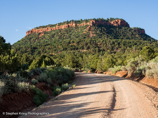
Up the dirt road to Bears Ears. To those iconic buttes (flat topped mountains) that are the focus of some political discussion these days. Things change, after all.

So let's go. Let's get out of this high desert summer heat. Up in elevation, and it won't take long. Not around here.

Crossing the National Forest boundary.
There's road dust behind me, even though I'm going slowly. It's been hot and dry around these parts lately. I slow down even more as I approach some folks going the other way. They wave and say "How are you doing?"

The East Ear, in summer afternoon light.
I pass between the Ears. Visitors, when viewing them from below, are startled to find out there is a road that goes right between them.

The shade of a Pinyon pine tree below the Bears Ears.
On the north side of the Ears, I once again do my best to savor the high mountain meadow scenery.

East Bears Ears Butte, from Elk Ridge.
The lupine were blooming in the high meadow. As usual I couldn't help but stop to admire.


But there were too many cows there, grazing on the public forage. So I Drove on.

Mule deer buck in velvet, Elk Ridge.
The deer were quite relaxed, mostly. They can feel when it's legal hunting season. Which it was not then.

Sunrise colors from camp.
I decided upon a campsite and settled in. Serenity in the forest.

 Photo location: San Juan County, southeast Utah.

© Copyright 2016 Stephen J. Krieg


Saving A Snake

Gopher snake, Natural Bridges highway.
June, and it's hot already, even at 6,500 feet. It's time to go higher. Up into the cooler mountains. Elk Ridge, beyond the Bears Ears Buttes.

But while driving out the Natural Bridges entrance road I suddenly swerved to the right. A fairly big snake was stretched across the centerline. Not a safe place to be.

I just missed driving over it myself. I pulled over to the side of the road, hoping I didn't hit even its tail. It hadn't been moving, and I was afraid it's been run over already, spine broken.

Walking up to it, (making sure it wasn't a rattlesnake), it looked fine. Nobody had run over it. Yet. It was a hot afternoon, but it seemed to be enjoying the heat of the pavement. What, is it not hot enough for you on the dirt to either side of the road?

Move, darn you. I went to its tail end and tried to look menacing. It worked, the snake started to move away. I crowded it some more. It slithered onto the dirt shoulder of the road.

My work there was done. I got back into my car, and within a few moments another car passed going the other way. The one that would likely have done my snake friend in.

Now it was time to drive up into the cool mountain forests.

Photo location: Natural Bridges National Monument, southeast Utah.

© Copyright 2016 Stephen J. Krieg